Templat:Infobox forest/doc
| Templat ini menggunakan Lua: |
Penggunaan
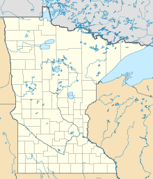
sunting| Richard J. Dorer Memorial Hardwood State Forest | |
|---|---|
| Geografi | |
| Lokasi | Southeastern Minnesota, United States |
| Koordinat | 44°31′13″N 92°27′18″W / 44.52028°N 92.45500°W |
| Area | 1.016.204 ekar (411.243,2 ha) |
| Administrasi | |
| Didirikan | 1961 |
| Lembaga pengelola | Minnesota Department of Natural Resources, Private |
{{Infobox forest
| name               = {{subst:PAGENAME}}
| native_name        =
| native_lang        =
| native_name2       =
| native_lang2       =
| photo              =
| photo_caption      =
| photo_width        =
| map                =
| map_caption        =
| map_width          =
| coordinates        =
| county             =
| region             =
| country            =
| elevation          =
| area               =
| max_area           =
| date_max_area      =
| status             =
| established        =
| visitation         =
| visitation_year    =
| events             =
| authority          =
| website            =
| ecosystem          =
| classification_WWF =
| classification_EPA =
| classification_CEC =
| disturbance        =
| forest_cover       =
| species            =
| indicator_plants   =
| lesser_flora       =
| fauna              =
}}
