Sutherland Shire
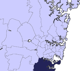
Sutherland Shire adalah sebuah Local Government Area di wilayah Southern Sydney, Sydney, Australia. Secara geografis, Sutherland Shire adalah daerah di selatan Botany Bay dan Georges River. Pusat administratif pemerintah daerah terletak di kota pinggiran Sutherland, dengan gedung dewan terletak di Eton Street. Sutherland Shire juga dikenal dengan sebutan "The Shire".[1]
| Sutherland Shire New South Wales | |||||||||||||||
|---|---|---|---|---|---|---|---|---|---|---|---|---|---|---|---|
 Letak di Sydney | |||||||||||||||
| Jumlah penduduk | 215,084 | ||||||||||||||
| • Kepadatan | 642,0/km2 (16.600/sq mi) | ||||||||||||||
| Luas | 335 km2 (129,3 sq mi) | ||||||||||||||
| Walikota | Clr Lorraine Kelly | ||||||||||||||
| Ibu kota dewan | Sutherland | ||||||||||||||
| Daerah | Metropolitan Sydney | ||||||||||||||
| Daerah pemilihan negara bagian | Cronulla, Heathcote, Menai, Miranda | ||||||||||||||
| Divisi Federal | Cook, Hughes | ||||||||||||||
| Situs web | Sutherland Shire | ||||||||||||||
| |||||||||||||||
Kota pinggiran
suntingKota pinggiran di Sutherland Shire adalah:
Pemukiman yang dikelola oleh Sutherland Shire adalah:
Lihat pula
suntingCatatan kaki
suntingPranala luar
sunting- Sutherland Shire Environment Centre Diarsipkan 2020-09-19 di Wayback Machine.
- Sutherland Shire Guide - Get On Up
- Sutherland Shire Online Diarsipkan 2010-01-05 di Wayback Machine.
- Children's Book Council of Australia (CBCA), Sutherland Sub branch - literacy in children and young adults of the Sutherland Shire Diarsipkan 2010-07-02 di Wayback Machine.