Rothwell
53°45′19″N 1°28′25″W / 53.755262°N 1.473640°W
| Rothwell | |
 Jalanan Niaga |
|
| Populasi | 21,010 |
|---|---|
| Ref. grid OS | SE345285 |
| Distrik metropolitan | Kota Leeds |
| County metropolitan | West Yorkshire |
| Region | Yorkshire and the Humber |
| Negara konstituen | Inggris |
| Negara berdaulat | Britania Raya |
| Kota pos | LEEDS |
| Distrik kode pos | LS26 |
| Kode telepon | 0113 |
| Polisi | West Yorkshire |
| Pemadam kebakaran | West Yorkshire |
| Ambulans | Yorkshire |
| Parlemen UE | Yorkshire and the Humber |
| Parlemen Britania Raya | Morley and Rothwell |
| Daftar tempat: Britania Raya • Inggris • Yorkshire | |
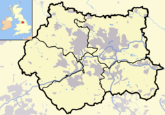
Rothwell adalah sebuah kota pasar di Sungai Dolphin di tenggara distrik metropolitan Kota Leeds, di West Yorkshire, Inggris. Daerah ini dibatasi oleh Oulton ke timur, Belle Isle di barat, Woodlesford di timur laut, dan Robin Hood di barat daya. Swillington, Methley dan Kippax terletak dekat Rothwell. Rothwell memiliki populasi sebesar 21.010[1] dan mendapatkan keuntungan dari beberapa perbaikan pada infrastruktur transportasi, terutama Jalan A1/M1 yang lewat di dekatnya. Rothwell merupakan bagian dari Daerah Perkotaan West Yorkshire. Stasiun kereta api terdekat adalah Stasiun Woodlesford.
Referensi
suntingPranala luar
sunting- (Inggris) Situs komunitas LS26 Diarsipkan 2008-09-07 di Wayback Machine.
- (Inggris) Rothwell Today Community Website
- (Inggris) The ancient parish of Rothwell atGENUKI
- (Inggris) Rothwell Colliery Country Park
